Real-time Earth intelligence

Track the entire planet, in real time.

Earth Realtime is a desktop command center that streams live aircraft, ships, satellites, public transit, cameras and weather onto one interactive globe — with always-on worldwide emergency monitoring and time-travel playback.

🚀 Launching soon See what it does
Free to start No account needed Windows 10 / 11 Private by design

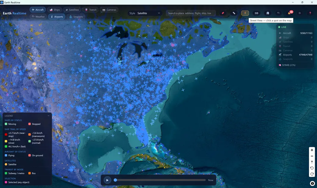
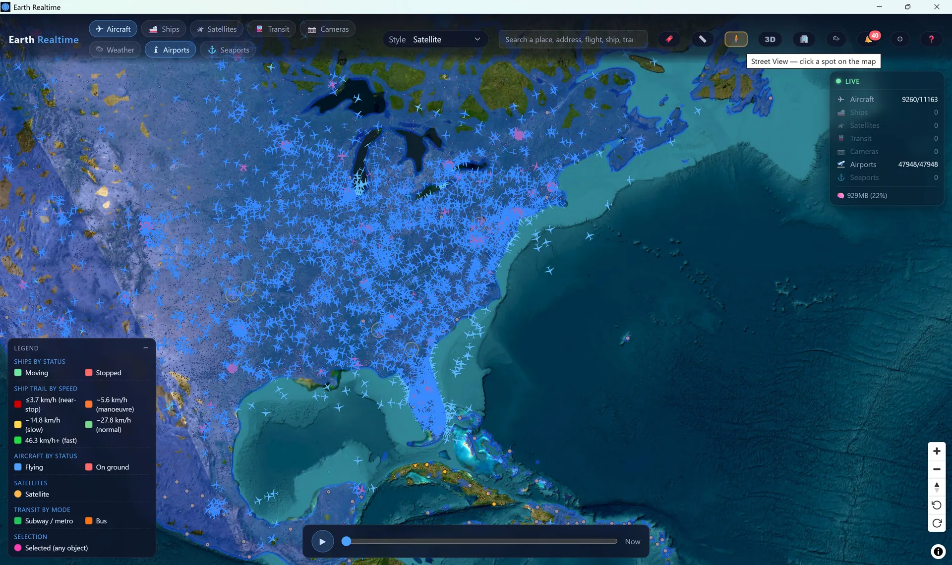
Earth Realtime showing thousands of live aircraft over North America on a satellite basemap
🚨 Emergency detectedSQUAWK 7700 · WORLDWIDE
🛰️ Up to 10,000 satsSGP4 · LIVE ORBITS

Fusing many live, public data feeds

4 merged ADS-B networks 3 AIS vessel feeds CelesTrak TLE / SGP4 GTFS-Realtime transit Live YouTube cameras Open-Meteo weather RainViewer radar GDACS disasters USGS earthquakes OGN gliders (FLARM) NOAA aurora OpenStreetMap basemaps
8
Live layers
47,948
Airports mapped
30,323
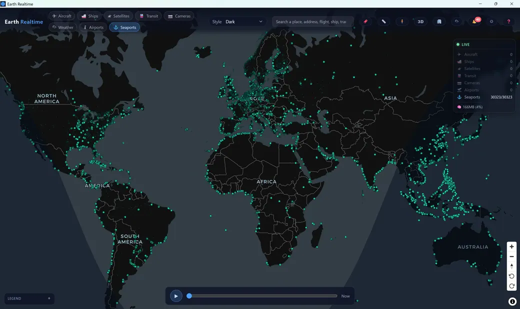
Seaports mapped
10,000
Satellites at once
3,000+
Curated live cameras
What makes it different

Every tracker shows one thing.
Earth Realtime shows everything.

Flight trackers show planes. Ship trackers show boats. Satellite apps show orbits. Earth Realtime fuses them all into a single live picture of the moving world — then adds capabilities no single-purpose app has.

🌐

All domains, one globe

Aircraft, ships, satellites, transit, cameras, weather, airports and seaports on the same map — cross-reference them instead of juggling eight browser tabs.

🚨

Alarms & alerts, always onPremium

Watchlists, proximity rules and emergency triggers fire interactive buzzers and custom sounds — and aircraft distress (7700 / 7600 / 7500) is caught worldwide even with the layer off, past the render cap or any filter, with ship AIS-SART distress too. An operations desk, not just a viewer.

📍

Geofences that alert & record

Draw a zone anywhere on the map and get alerted the instant any object enters or leaves — and record it. Combine with per-object tracking for evidence-grade capture.

⏱️

Time-travel playbackPremium

Scrub the timeline to rewind and replay what just happened, record the map or one or many objects at once for very long sessions, and auto-capture emergencies as they unfold.

🎯

Surgical filtering

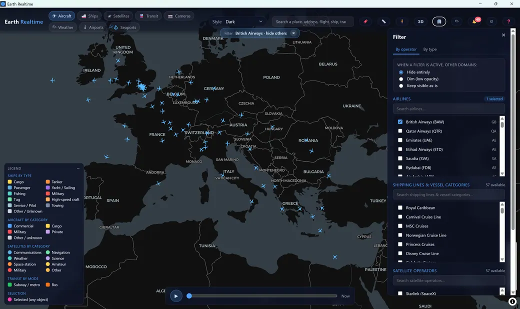
Show only one airline's fleet, one aircraft type, one satellite constellation — Starlink alone — or one transit agency, across every domain, with type-colored legends. See exactly what you ask for.

🏙️

3D & Street View, built in

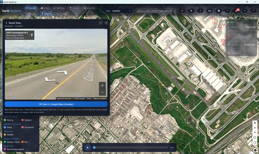
Drop into 3D cities and Google Street View from anywhere on the map — no context-switching, no extra windows.

🔑

Your keys, your privacy

Runs on open feeds plus your own free API keys, and keeps zero personal data. Your feeds, your machine — nothing about you is collected or sold.

Native desktop performance

A Rust core renders tens of thousands of live objects smoothly and auto-tunes memory to your RAM. This isn't a laggy web widget — it's a real application.

Capability Typical single-purpose tracker Earth Realtime
Live aircraft (ADS-B)✓ aircraft apps
Live ships (AIS)✗ separate app
Live satellites (SGP4 orbits)✗ separate app
Public transit (GTFS-Realtime)
Curated live cameras3,000+
Weather, radar & global disasters✗ rarely
Worldwide emergency monitoringAlways on
Time-travel record & replay
Geofence zones that alert & record
Custom alarms, watchlists & buzzers
Surgical filters across every domain✗ own domain only✓ all domains
3D cities & Street View
Everything on one unified map
Native app, no forced subscription✗ ads / paywallsFree + BYO key
Eight live layers

One map. Everything that moves.

Toggle any combination of layers and watch the world update in real time. Click any object for deep, plain-language detail.

✈️

Aircraft ADS-B

Live flights from 4 merged ADS-B networks (field-level merge — no flicker) plus gliders and paragliders via the Open Glider Network (FLARM) — with callsign, type, altitude, speed, route and decoded telemetry, colored by category.

🚢

Ships AIS

Vessels from 3 AIS feeds — including Norwegian and Finnish government infrastructure — with name, type, course, destination, ETA, dimensions and a photo, moving vs. stopped at a glance.

🛰️

Satellites SGP4

Up to 10,000 objects propagated live, with orbit rings, ground tracks and visible-pass predictions.

🚆

Transit GTFS-RT

Live buses, subways and metros streamed from agency real-time feeds, colored by mode.

📷

Live Cameras 3,000+

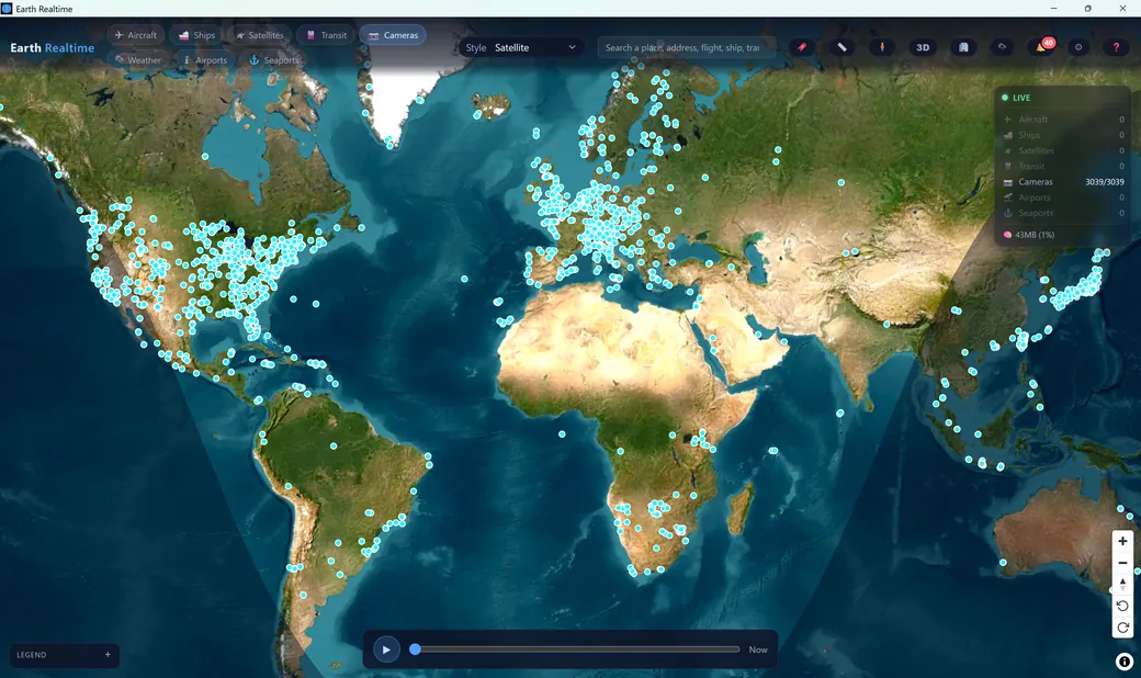
A hand-curated catalog of live YouTube webcams worldwide — embedded and playable right on the map.

☁️

Weather Radar

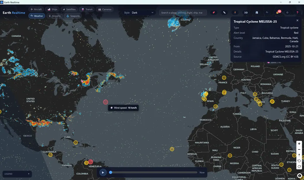
Animated radar, satellite, wind particles, temperature, UV and more — plus GDACS global disaster alerts.

🛬

Airports 47,948

Every airport with live arrivals and departures within range, ranked by distance and altitude.

Seaports 30,323

Global seaports mapped and searchable, ready to cross-reference against live vessel traffic.

A closer look

Built like a mission-control console.

Not a toy map — a dense, responsive instrument for reading the moving world.

Earth Realtime — aircraft
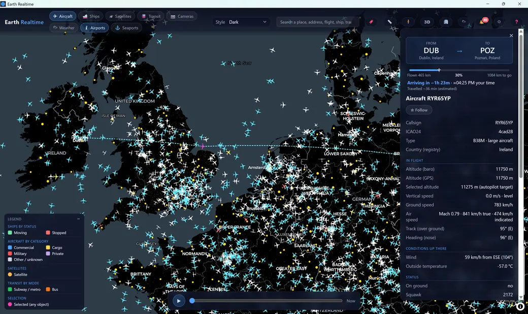
Aircraft details panel showing a Dublin to Poznań flight with altitude, speed, Mach, winds aloft and squawk
✈️ Aircraft

Deep flight telemetry, decoded into plain English

Click any aircraft for its route, a live flight-progress bar and estimated ETA, plus dozens of ADS-B fields — baro & GPS altitude, selected altitude, Mach, winds aloft, outside air temperature, squawk and data source.

  • Category colors: commercial, cargo, military, private
  • Gliders too, via the Open Glider Network (FLARM)
  • Follow a target, filter by operator, show trails
Earth Realtime — ships
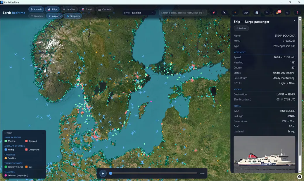
Ship details panel for the ferry Stena Scandica showing speed, heading, destination, ETA, IMO and dimensions with a vessel photo
🚢 Ships

Every vessel, from ferries to freighters

Live AIS positions with name, MMSI, type, speed, course and navigation status, plus voyage destination and ETA, IMO number, call sign, dimensions and draft — and a photo of the ship where available.

  • 3 AIS feeds, incl. Norwegian & Finnish government infrastructure
  • Persistent 80,000-vessel name cache — ships recognized instantly
  • Moving vs. stopped, with speed-graded trails
  • Distress (AIS-SART) surfaced while the Ships layer is on
  • Cross-reference against 30,000+ seaports
Earth Realtime — satellites
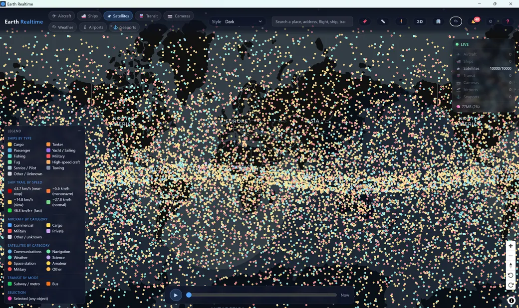
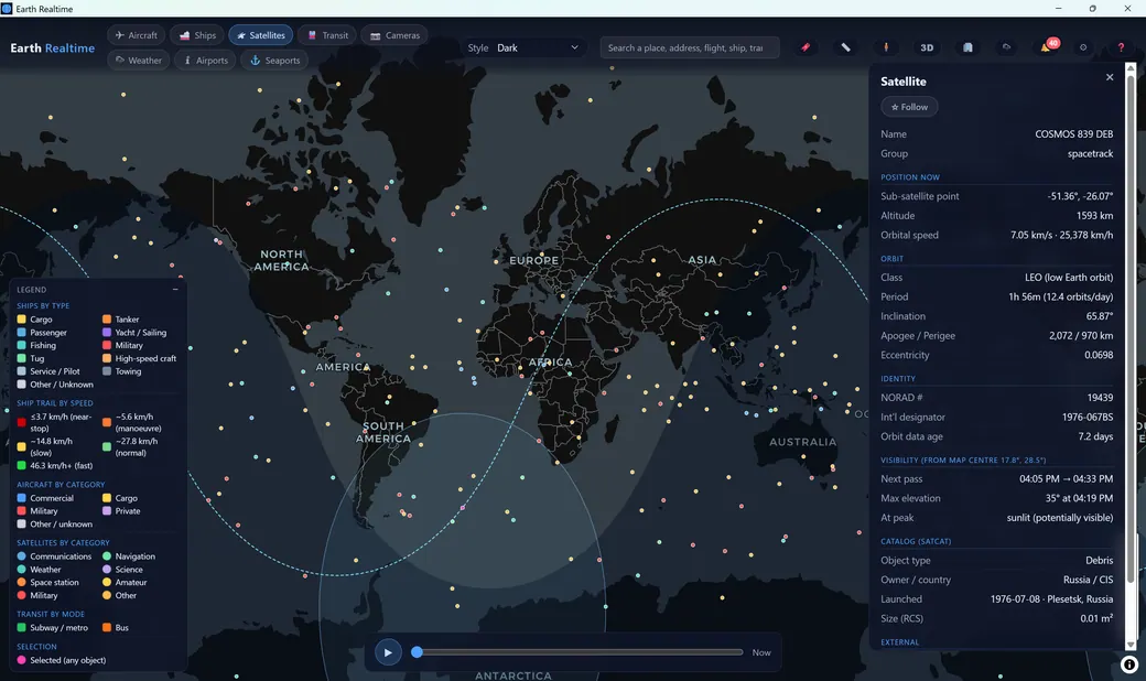
Ten thousand satellites colored by category forming orbital bands across the globe
🛰️ Satellites

The sky above you, propagated in real time

Earth Realtime pulls fresh two-line elements and runs SGP4 orbit propagation on-device — up to 10,000 objects at once, colored by category, with orbit rings, ground tracks and coverage footprints. Click one for its altitude, period, apogee/perigee and full SATCAT identity.

  • Sunlit visible-pass predictions & sky-watch mode from your location
  • Filter by network — Starlink alone, or just GPS
  • Categories — comms, navigation, weather, science & more
  • Resilient multi-source TLE ingestion
Earth Realtime — transit
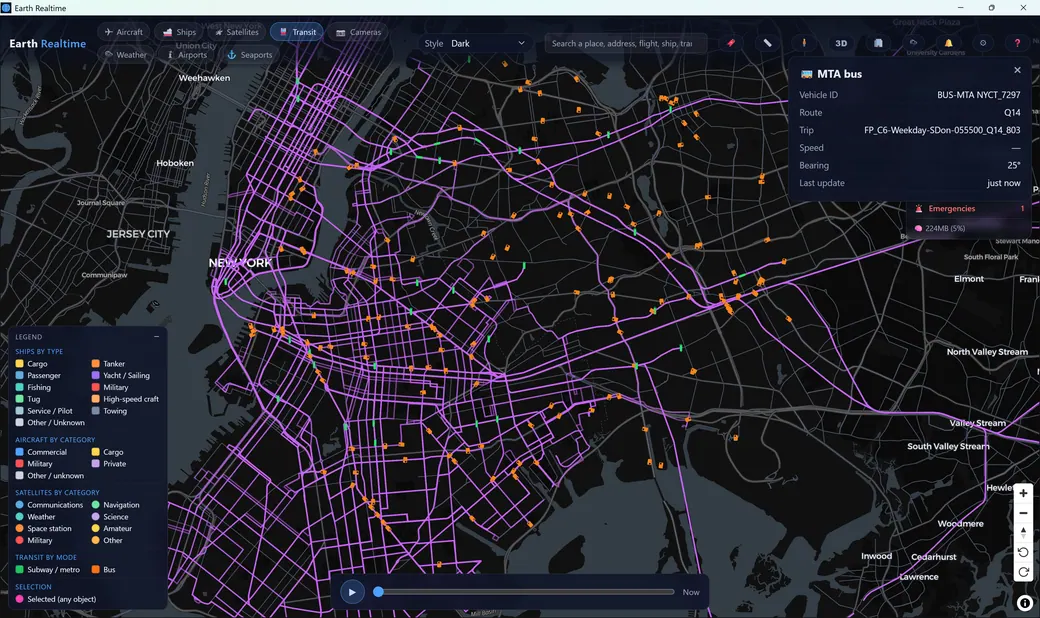
Live New York MTA buses and subways on the purple transit route network with a bus detail panel
🚆 Transit

Buses and metros, moving in real time

Stream live public-transit vehicles straight from agency GTFS-Realtime feeds, drawn over their route network and colored by mode. Click any vehicle for its route, trip, bearing and last update.

  • Subway/metro vs. bus, color-coded
  • Live route lines light up the whole network
  • New cities & agencies added regularly
Earth Realtime — weather
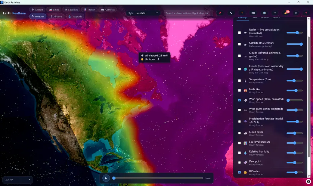
Weather overlay panel with animated wind speed and temperature layers over North America
☁️ Weather & disasters

A full weather stack layered under the traffic

Animated precipitation radar, true-color satellite, infrared clouds, animated wind particles and gusts, temperature, pressure, humidity, dew point and UV — with a timeline and forecast models.

  • Global disasters: GDACS storms & floods, USGS earthquakes, live aurora
  • Day/night terminator shading on the globe
  • See the storm your tracked flight is flying around
Earth Realtime — emergencies
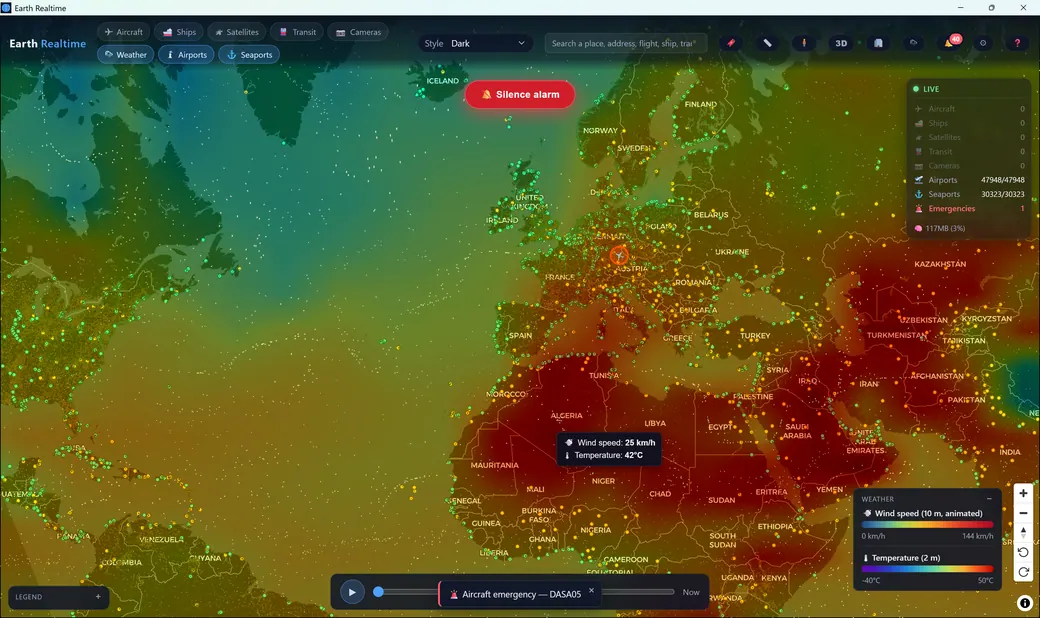
An aircraft emergency highlighted worldwide with a silence-alarm control over a temperature heatmap
🚨 Alarms & emergency monitoring

It watches even when you aren't

Watchlists, proximity rules and emergency triggers fire interactive buzzers and custom alert sounds — the feel of a live operations desk. A lightweight background sweep catches aircraft squawking 7700, 7600 or 7500 anywhere ADS-B data reaches — even while the Aircraft layer is off, past the render cap, off-screen or filtered out — and ships broadcasting AIS-SART distress are surfaced too while the Ships layer is on. Every alert is pinned worldwide with a pulsing halo, and the global emergency dashboard lists every active emergency on Earth in one place.

  • Interactive buzzers, custom sounds & auto-record
  • Covers both aircraft squawks & ship AIS-SART distress
  • Global emergency dashboard — every active emergency, one list
Earth Realtime — cameras
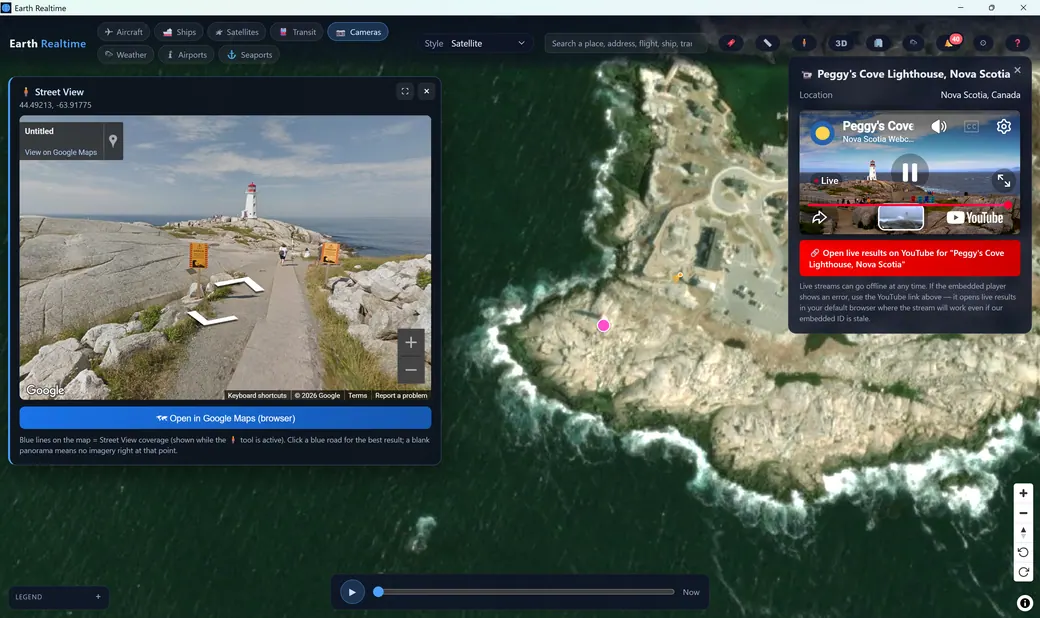
A live webcam of Peggy's Cove Lighthouse playing in a panel beside Street View
📷 Live cameras

3,000+ live views of the real world

A continuously curated catalog of live YouTube webcams — lighthouses, harbors, city squares, airports and wildlife — embedded and playable directly on the globe, each health-checked so dead streams are pruned automatically.

  • Pair a camera with Street View for full context
  • Open live results on YouTube in one click
  • Premium: post your own cameras to a community layer
Earth Realtime — 3D view
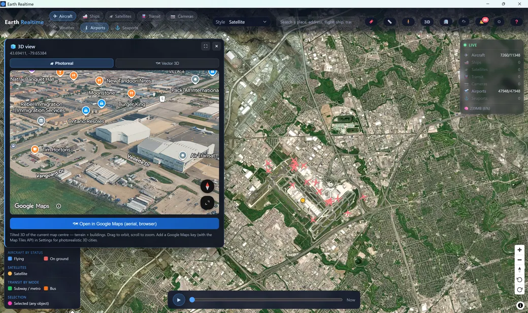
Tilted photoreal 3D view of buildings and terrain near an airport
🏙️ 3D & Street View

Go from orbit to street level

Tilt into vector 3D anywhere — or photoreal 3D where Google has it, with a key — to orbit terrain and buildings, then drop the pegman into Google Street View. Add a Google Maps key and a live view-cone follows you as you walk.

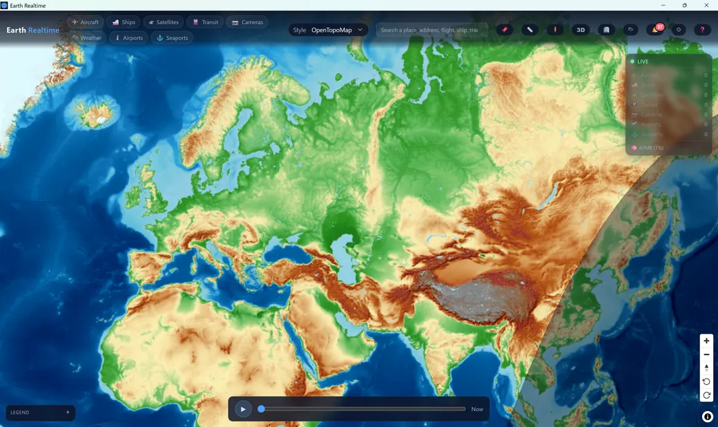
  • Multiple basemaps: Dark, Voyager, Satellite, Topo
  • Street View coverage overlay & fullscreen
  • Add a Google key to unlock photoreal 3D cities
Earth Realtime — airports
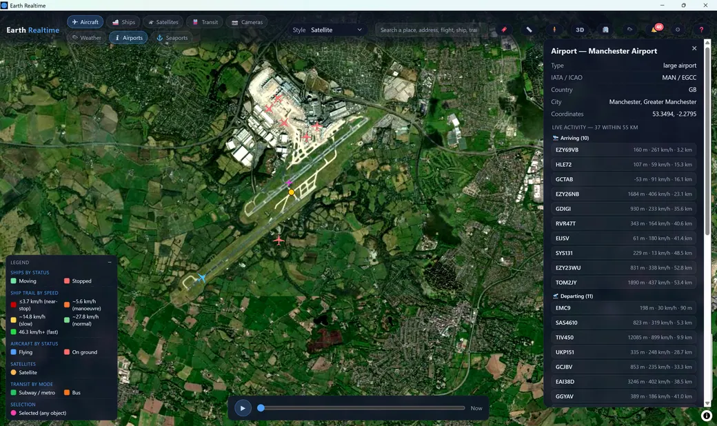
Manchester Airport panel listing live arriving and departing flights with distance and altitude
🛬 Airports & ⚓ Seaports

Infrastructure, live and in context

Select any of 47,948 airports to see the live flights arriving and departing nearby right now — ranked by distance, altitude and speed from live ADS-B. 30,323 seaports sit ready to cross-reference against live vessel traffic.

  • Live nearby-traffic radius per airport
  • IATA/ICAO, type and location detail
  • Search any place, address, flight, ship or transit line
Always expanding

The map keeps growing.

Earth Realtime is in active development. Coverage and capabilities expand continuously — here's what's rolling out.

📷

More live cameras

The curated catalog grows every week — new cities and wider coverage, each stream health-checked so dead feeds are pruned automatically. Premium users can add their own to a community layer.

🚆

Wider transit coverage

New metro and bus networks are added regularly, bringing live public-transit tracking to cities that aren't covered yet — with more agencies on the way.

🧭

New features, always

Deeper detail, more live data feeds, richer telemetry, and bigger capabilities ship on a steady cadence — with macOS, Linux and mobile builds on the roadmap.

Simple, honest tiers

Start free. Upgrade when you're hooked.

Download and use Earth Realtime for free. Unlock the full professional toolkit whenever you're ready — all from inside the app.

Free

$0

forever · 1 device

A single-domain live viewer that goes head-to-head with the big flight-tracking apps — free.

  • One live layer at a time — aircraft, ships or satellites
  • Live positions, route lines & identifying info
  • Basic weather (clouds, temperature, precipitation)
  • Multiple basemaps & day/night shading
🚀 Launching soon
Most popular

Advanced

$4.99/month

or $39/year save 35% · works on 2 devices

The full live pro viewer — all layers, together.

  • All eight layers on the map at once
  • Full telemetry, filters, type colors & trails
  • Emergency highlighting, ETA & pass predictions
  • Full & severe weather + GDACS disasters
  • Transit, cameras, airports & seaports
  • Full-map recording
  • Measurement, saved views & data-health
🚀 Launching soon

Premium

$9.99/month

or $79/year save 34% · works on 3 devices

Everything, plus recording & time travel.

  • Everything in Advanced
  • Record one or many objects at once, for very long sessions (per-object session files)
  • Auto-record objects in emergency
  • Full time-travel playback
  • Global emergency dashboard
  • Custom alarms, watchlists & buzzers
  • Post your own live cameras (Community layer)
  • Higher limits — works on 3 devices
🚀 Launching soon

7-day free trial of full Premium — built into the app, no card required. Upgrade, downgrade or manage your plan any time from inside the app — checkout, invoices and renewals are handled securely by Lemon Squeezy (a Stripe company), our merchant of record.

Up and running in a minute

Three steps to a live planet

Download

Grab the Windows installer — a single click, no account and no sign-up required.

Install & launch

Run the installer and open Earth Realtime. It starts streaming live data immediately on the free tier.

Track the world

Toggle layers, click objects, add your own free API keys for more feeds, and start your 7-day Premium trial whenever you like — no card required.

🚀 Launching soon

The Windows 10 / 11 (64-bit) installer is almost ready  ·  macOS, Linux & mobile on the roadmap

Good to know

Frequently asked questions

Is Earth Realtime free?
Yes — the free tier is a genuinely useful live tracker with one layer at a time plus basic weather. Advanced ($4.99/month or $39/year, works on 2 devices) unlocks all layers together, and Premium ($9.99/month or $79/year, works on 3 devices) adds recording, time travel and the emergency toolkit. There's a 7-day free trial of full Premium — built into the app, no card required.
Do I need API keys?
Many core feeds work out of the box. Some data sources (certain aircraft, transit and mapping providers) use your own free API keys, which you paste into Settings. Keys are yours and stay on your machine — Earth Realtime is a client tool that connects on your behalf.
Is my data private?
Yes. The app collects no personal information. Your API keys and preferences stay on your device, and licensing stores only an anonymous license hash and machine fingerprint — no emails or payment details, which live only with our payment processor.
Where does the data come from?
Dozens of live, open feeds: ADS-B for aircraft, AIS for ships, CelesTrak two-line elements for satellites, GTFS-Realtime for transit, Open-Meteo and RainViewer for weather and radar, GDACS and USGS for disasters and earthquakes, curated YouTube for live cameras, and OpenStreetMap-based basemaps — all fused on-device.
How does worldwide emergency monitoring work?
It covers both the skies and the seas. Aircraft squawking 7700, 7600 or 7500 are caught by a lightweight worldwide sweep — even when the Aircraft layer is switched off, beyond your render cap, off-screen, or hidden by a filter. Ships broadcasting an AIS-SART distress signal are surfaced globally while the Ships layer is on. Either way, distress is pinned on the map with a pulsing halo, an audible alarm and an entry in the emergency dashboard — past any cap, zoom or filter.
What are the system requirements?
A 64-bit Windows 10 or 11 PC. Earth Realtime automatically tunes its memory use to your available RAM, so higher render limits are only as heavy as your machine allows. An internet connection is required for live data.
How do I upgrade or manage my subscription?
Everything happens inside the app under the Help menu — see your tier and days remaining, and open secure checkout or the customer portal. Advanced is $4.99/month or $39/year; Premium is $9.99/month or $79/year. Billing, invoices, taxes and renewals are handled by Lemon Squeezy (a Stripe company), our merchant of record.
Which platforms are supported?
The Windows 10/11 (64-bit) build is launching soon — it's the first platform out the door. macOS, Linux and mobile builds are on the roadmap.
Ready when you are

The moving world, on your desktop.

Download Earth Realtime and watch aircraft, ships, satellites, transit, cameras and weather come alive on a single globe.

🚀 Launching soon Compare plans